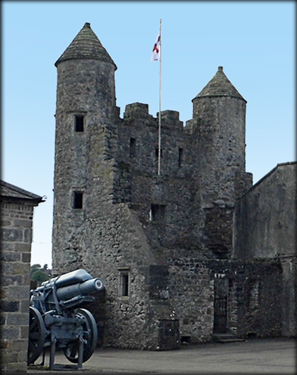
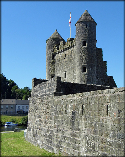
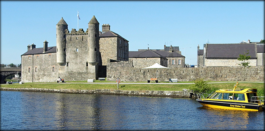
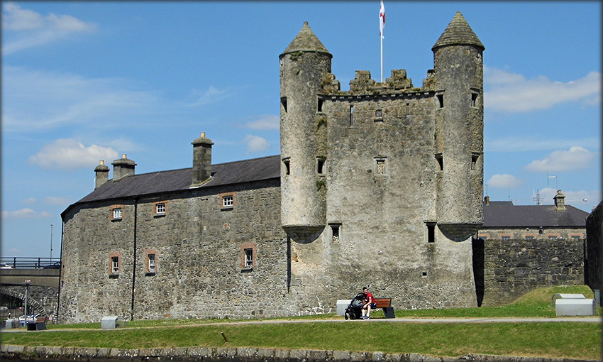
Enniskillen 17th Century Plantation Castle and Museum Enniskillen Castle is a multi-period complex, consisting of a 15th century Keep, which now houses the Inniskillings Regimental Museum, the Fermanagh County Museum and the 17th century Watergate, pictured below. The original castle/keep was a Maguire stronghold. Built as a fortified residence in the first quarter of the 15th century the structure was greatly altered during the plantation period. Sir William Cole, an English planter and soldier, who also constructed Portora castle, rebuilt the upper floors. Cole who took command of Enniskillen Castle in 1607, is also credited with the construction of the Watergate tower. The Cole family remained at Enniskillen until 1710, when after a fire they moved to Portora Castle. Excavation at Enniskillen revealed that the tower, with its stunning twin turrets was never actually used as a water gate. The cobelling of the turrets is probably its only Scottish feature, the crenellations are in the Irish style. Its appearance generally is more of a continental style. Scottish corbelling is also a feature at Castle Balfour, Monea Castle, Roughan Castle in Northen Ireland and Parke's Castle and Rathlee Castle in the Republic.
|
|
|---|---|
 |
 |
 |
|
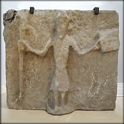
Fermanagh County Museum Aghalurcher The descriptions of the following artifacts are all taken from the information signs present at the Enniskillen County Museum. The 'Bishop's Stone' below left is a 12th century carving of a bishop taken from Aghalurcher graveyard near Lisnaskea. It was probably part of a Romanesque church on site. According to tradition it marked the burial place of Bishop Roger or Ross Maguire who died in 1483. The 12th century carving of a male exhibitionist, below right, was found in 1966 built into the walls of the ruined church at Aghalurcher. The figure sybolises the sins of the flesh and was intended as a warning to the faithful. Later it became customary to use a female figure or 'Sheela-na-gig'. |
|
 |
 |
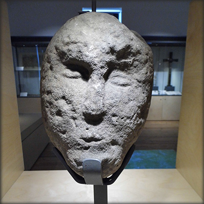
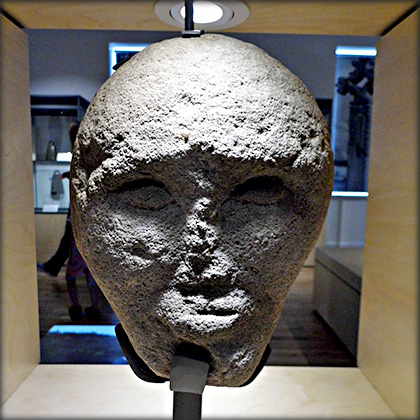
Cleenish Island The pair of stone heads pictured below, are said to come from Cleenish Island. Cleenish was an important Early Christian monastery where St Columbanus first studied in the 6th century. It was the site of a later medieval parish church and pilgrim guesthouse. These stones were probably part of the church. |
|
 |
 |
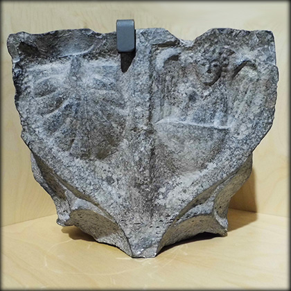
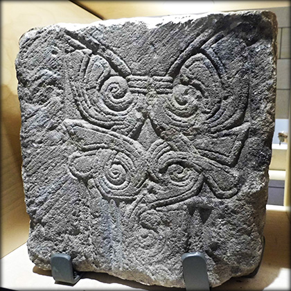
Inishkeen Island Inishkeen is the site of an Early Christian monastery, a Romanesque church and a later medieval church. The stone on the left is decorated with an angel standing in a boat beside a large scallop shell. It probably refers to the legend of St James's body guarded by an angel on its miraculous journey from Judea to Spain. The stone possibly commemorates chieftain Thomas Óg Maguire's pilgrimage to Santiago de Compostella in Spain in 1450. The Romanesque style of architecture was adopted in Ireland in the 12th century. The stone on the right is one of several beautifully decorated stones on display from the Romanesque church on Inishkeen. |
|
 |
 |
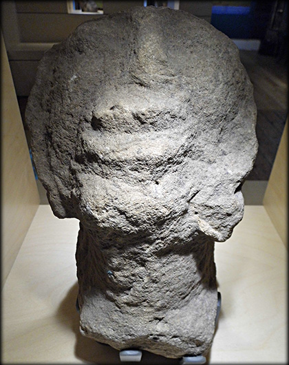
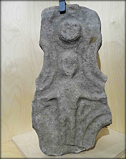
Inishkeen Grotesque Head and Killesher Cross Fragment Also on display from Inishkeen is the grotesque head pictured below left. It possibly came from the later 15th century medieval church. The head has a long outreached neck and was designed to be viewed from below. the fragment of a High Cross, below right, was discovered in the old parish graveyard of Killesher. It is probably 11th to early 12th century in date and shows Christ crucified on one side. The female saint, St Lassair, is said to have founded the first church on Killesher. |
|
 |
 |
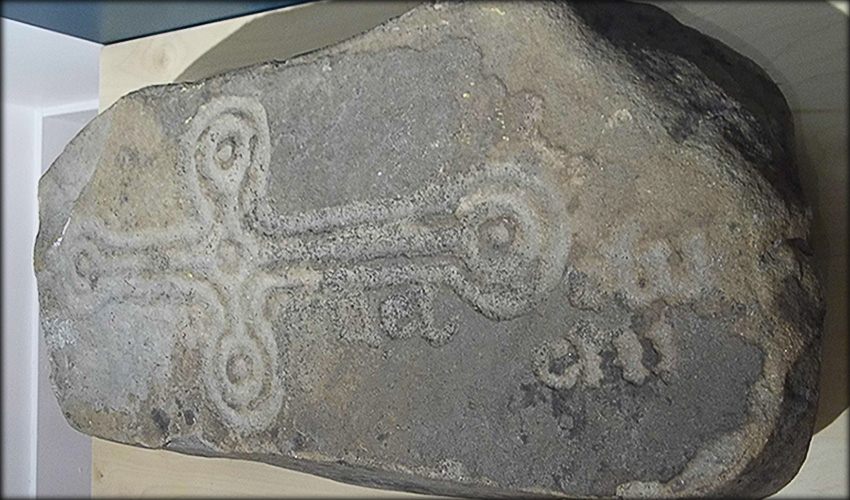
Kilcoo Cross Slab This fine cross slab was found at the early church site at Kilcoo in the Frevagh and Slattinagh townlands, lying against a tree trunk. The slab originally lay flat on top of the grave of a person called Maelcluchi, indentified by the inscription in Irish Or(oit) du Mael Cluchi, ( a prayer for Maelcluchi). |
|
 |
|
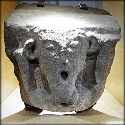
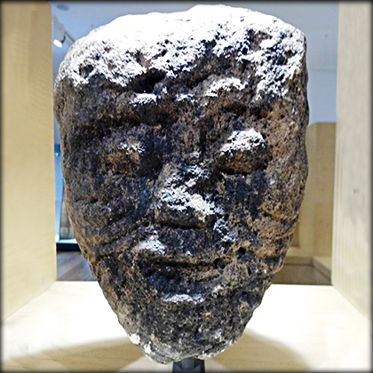
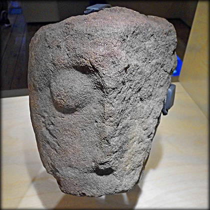
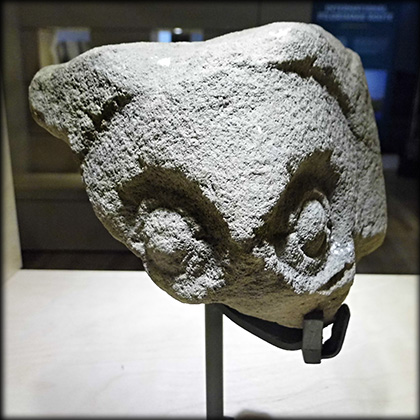
Keenaghan and Kiltierney Heads The grotesque stone head, below right, was found at Kiltierney, the site of an early monastery and later medieval grange. The grange was a farming estate belonging to the Cistercian Abbey of Assaroe in Donegal. The grotesque carved head, below left, with prominent eyes and a wide gaping mouth was discovered in 1971, on the shore of Keenaghan Lough, a short distance from the ruins of the medieval church at Tievealough near Belleek. |
|
 |
 |
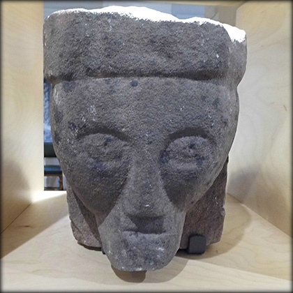
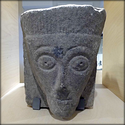
Lough Erne The pair of stone heads pictured below came from a medieval church of unknown location in the region of Lough Erne. They are both wearing what looks like a pill-box type of head-dress. They may have served as corbels or labelstops. The fragment of a stone head, pictured bottom, was uncovered at a 'lost' Romanesque church on Devenish Island also on Lough Erne. |
|
 |
 |
Situated: The Castle and Museum are situated on Wellington Road on the east bank on the River Erne in the Centre of Enniskillen' Discovery Map 17: H 23123 44187. Last visit July 2026. Longitude: 7° 38' 42.5" W Latitude: 54° 20' 45.5" N Photos: José Gutiérrez. |
|
Ref: Northern Ireland Sites and Monuments Record website. Ref: Enniskillen Castle and Museums. Ref: Jope, E. M. “Scottish Influences in the North of Ireland: Castles with Scottish Features, 1580-1640.” Ulster Journal of Archaeology, vol. 14, 1951, pp. 31–47. JSTOR, http://www.jstor.org/stable/20566632. |
|
Previous----Home-----Next Page